 vesseltracker.com
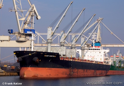
 SAINT DIMITRIOS
Current Status
Where is the vessel?
SAINT DIMITRIOS is currently in 92 nm NE of Corcos, based on AIS data received about 2h ago.
Latest AIS update:
Current position: 43.19333° N, 43.28333° W (92 nm NE of Corcos)
Average speed (last 7 days): Loading…
Average speed (last 30 days): Loading…
Vessel profile: SAINT DIMITRIOS is a Bulk Carrier with dimensions m x m.
This page combines live AIS, route history, probable destination signals, nearby traffic, and port activity for practical vessel monitoring.
The current position of vessel SAINT DIMITRIOS is 43.19333 lat / -43.28333 lng. Updated: 2026-05-13 23:33:28 UTCCurrently sailing under the flag of Portugal ![]()
Details:
Live Vessel SAINT DIMITRIOS Analytics (details, animations, etc.)
Recent AIS points (UTC):
2026-05-13 19:53:35 UTC · 42.71950, -43.89547 · SOG 10 kn · COG 47°2026-05-13 21:35:47 UTC · 42.93958, -43.61335 · SOG 11.3 kn · COG 49°
2026-05-13 22:30:30 UTC · 43.05667, -43.45667 · SOG 10 kn · COG -1°
2026-05-13 23:33:28 UTC · 43.19333, -43.28333 · SOG 10 kn · COG -1°