 vesseltracker.com
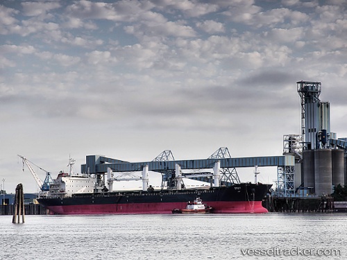
 KIRWAN
Current Status
Where is the vessel?
KIRWAN is currently in Near Ablogamé, based on AIS data received about 1h ago.
Latest AIS update:
Current position: 6.01575° N, 1.33370° E (Near Ablogamé)
Average speed (last 7 days): Loading…
Average speed (last 30 days): Loading…
Vessel profile: KIRWAN is a Bulk Carrier with dimensions 190m x 33m.
This page combines live AIS, route history, probable destination signals, nearby traffic, and port activity for practical vessel monitoring.
The current position of vessel KIRWAN is 6.01575 lat / 1.33370 lng. Updated: 2026-05-15 07:39:40 UTCNearest reference points:
- Near Ablogamé
- Near Cotonou
- Near Kirikiri
Currently sailing under the flag of Marshall Islands ![]()
KIRWAN built in 2008 year
Deadweight:
53208 tDetails:
Live Vessel KIRWAN Analytics (details, animations, etc.)
Recent AIS points (UTC):
2026-05-15 04:38:21 UTC · 6.01548, 1.33405 · SOG 0.3 kn · COG 223°2026-05-15 06:18:04 UTC · 6.01590, 1.33334 · SOG 1 kn · COG 200°
2026-05-15 07:09:28 UTC · 6.01573, 1.33370 · SOG 0.1 kn · COG 214°
2026-05-15 07:39:40 UTC · 6.01575, 1.33370 · SOG 0.4 kn · COG 216°