 vesseltracker.com
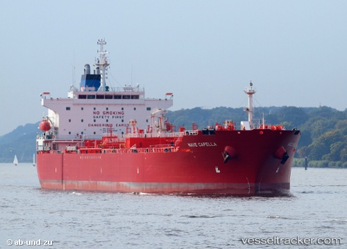
Nave Capella
Current StatusWhere is the vessel?
Nave Capella is currently in 26 nm NE of AL JUBAIL, based on AIS data received about 1h ago.
Latest AIS update:
Current position: 27.28193° N, 50.14753° E (26 nm NE of AL JUBAIL)
Average speed (last 7 days): Loading…
Average speed (last 30 days): Loading…
Vessel profile: Nave Capella is a Chemical Oil Products Tanker with dimensions 30m x 183m.
This page combines live AIS, route history, probable destination signals, nearby traffic, and port activity for practical vessel monitoring.
The current position of vessel Nave Capella is 27.28193 lat / 50.14753 lng. Updated: 2026-05-13 19:51:53 UTCNearest reference points:
- 13 nm NE of AL JUBAIL
- Near Al Jubayl
- Near Sayhat
Details:
Live Vessel Nave Capella Analytics (details, animations, etc.)
Recent AIS points (UTC):
2026-05-13 16:43:21 UTC · 27.30975, 50.13744 · SOG 0.6 kn · COG 3°2026-05-13 18:25:51 UTC · 27.29904, 50.14433 · SOG 0.8 kn · COG 62°
2026-05-13 19:39:52 UTC · 27.28398, 50.14702 · SOG 0.6 kn · COG 49°
2026-05-13 19:51:53 UTC · 27.28193, 50.14753 · SOG 0.6 kn · COG 50°