 vesseltracker.com
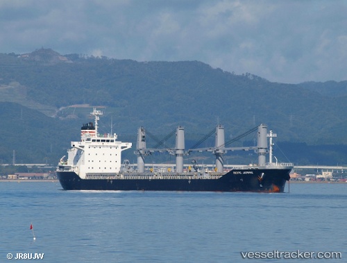
 RUBATO
Current Status
Where is the vessel?
RUBATO is currently in 50 nm N of TAN TAN, based on AIS data received less than 1h ago.
Latest AIS update:
Current position: 29.31500° N, 11.36167° W (50 nm N of TAN TAN)
Average speed (last 7 days): Loading…
Average speed (last 30 days): Loading…
Vessel profile: RUBATO is a Bulk Carrier with dimensions m x m.
This page combines live AIS, route history, probable destination signals, nearby traffic, and port activity for practical vessel monitoring.
The current position of vessel RUBATO is 29.31500 lat / -11.36167 lng. Updated: 2026-04-25 04:17:30 UTCNearest reference points:
- 84 nm NE of ORZOLA
- 120 nm W of Anza
- 125 nm W of Essaouira
Currently sailing under the flag of Antigua and Barbuda ![]()
Details:
Live Vessel RUBATO Analytics (details, animations, etc.)
Recent AIS points (UTC):
2026-04-24 23:56:10 UTC · 29.45439, -11.19126 · SOG 2.5 kn · COG 271°2026-04-25 01:29:50 UTC · 29.40110, -11.25045 · SOG 3.4 kn · COG 270°
2026-04-25 01:29:50 UTC · 29.40110, -11.25045 · SOG 3.4 kn · COG 270°
2026-04-25 04:17:30 UTC · 29.31500, -11.36167 · SOG 2 kn · COG -1°