 vesseltracker.com
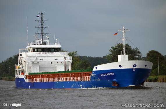
 KIRSI
KIRSI
Current Status
Where is the vessel?
KIRSI is currently in Near Palmones, based on AIS data received about 1h ago.
Latest AIS update:
Current position: 36.17533° N, 5.41892° W (Near Palmones)
Average speed (last 7 days): Loading…
Average speed (last 30 days): Loading…
Vessel profile: KIRSI is a General Cargo with dimensions 104m x 16m.
This page combines live AIS, route history, probable destination signals, nearby traffic, and port activity for practical vessel monitoring.
The current position of vessel KIRSI is 36.17533 lat / -5.41892 lng. Updated: 2026-05-16 07:45:21 UTCNearest reference points:
- Near Palmones
- Near La Línea de la Concepción
- Near Algeciras
Currently sailing under the flag of Antigua Barbuda ![]()
KIRSI built in 0 year
Deadweight:
0 tDetails:
ex Alexander
Live Vessel KIRSI Analytics (details, animations, etc.)
Recent AIS points (UTC):
2026-05-16 05:09:16 UTC · 36.17534, -5.41893 · SOG 0 kn · COG 336°2026-05-16 05:51:16 UTC · 36.17536, -5.41892 · SOG 0 kn · COG 336°
2026-05-16 07:18:17 UTC · 36.17534, -5.41890 · SOG 0 kn · COG 336°
2026-05-16 07:45:21 UTC · 36.17533, -5.41892 · SOG 0 kn · COG 336°