 vesseltracker.com
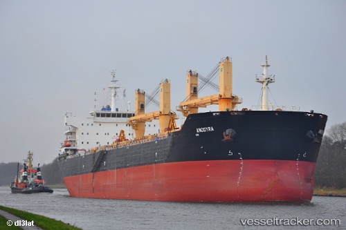
 ANDREAS K
Current Status
Where is the vessel?
ANDREAS K is currently in 220 nm SW of Ile Desroches, based on AIS data received about 1h ago.
Latest AIS update:
Current position: 8.47833° S, 51.28833° E (220 nm SW of Ile Desroches)
Average speed (last 7 days): Loading…
Average speed (last 30 days): Loading…
Vessel profile: ANDREAS K is a Bulk Carrier with dimensions 32m x 190m.
This page combines live AIS, route history, probable destination signals, nearby traffic, and port activity for practical vessel monitoring.
The current position of vessel ANDREAS K is -8.47833 lat / 51.28833 lng. Updated: 2026-05-14 20:07:47 UTCNearest reference points:
- 219 nm W of Ile Desroches
- 118 nm W of Ile Desroches
Currently sailing under the flag of Liberia ![]()
ANDREAS K built in 2011 year
Deadweight:
56729 tDetails:
Live Vessel ANDREAS K Analytics (details, animations, etc.)
Recent AIS points (UTC):
2026-05-14 16:16:50 UTC · -8.47667, 51.99167 · SOG 10 kn · COG -1°2026-05-14 17:40:45 UTC · -8.47833, 51.74167 · SOG 10 kn · COG -1°
2026-05-14 19:25:47 UTC · -8.47833, 51.41500 · SOG 10 kn · COG -1°
2026-05-14 20:07:47 UTC · -8.47833, 51.28833 · SOG 10 kn · COG -1°