 vesseltracker.com
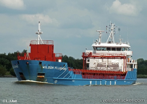
 Wilson Flushing
Current Status
Where is the vessel?
Wilson Flushing is currently in Near Foynes, based on AIS data received less than 1h ago.
Latest AIS update:
Current position: 52.61333° N, 9.10833° W (Near Foynes)
Average speed (last 7 days): Loading…
Average speed (last 30 days): Loading…
Vessel profile: Wilson Flushing is a Multi Purpose Carrier with dimensions 90m x 15m.
This page combines live AIS, route history, probable destination signals, nearby traffic, and port activity for practical vessel monitoring.
The current position of vessel Wilson Flushing is 52.61333 lat / -9.10833 lng. Updated: 2026-04-29 16:07:19 UTCNearest reference points:
- Near Tarbert Island
- Near Skull
- Near CASTLETOWN BEARHAVEN
Currently sailing under the flag of Barbados ![]()
Wilson Flushing built in 2012 year
Deadweight:
4321 tDetails:
Live Vessel Wilson Flushing Analytics (details, animations, etc.)
Recent AIS points (UTC):
2026-04-29 13:36:14 UTC · 52.61353, -9.10954 · SOG 0 kn · COG 106°2026-04-29 13:48:14 UTC · 52.61351, -9.10952 · SOG 0 kn · COG 106°
2026-04-29 16:06:17 UTC · 52.61351, -9.10953 · SOG 0 kn · COG 107°
2026-04-29 16:07:19 UTC · 52.61333, -9.10833 · SOG 0 kn · COG -1°