 vesseltracker.com
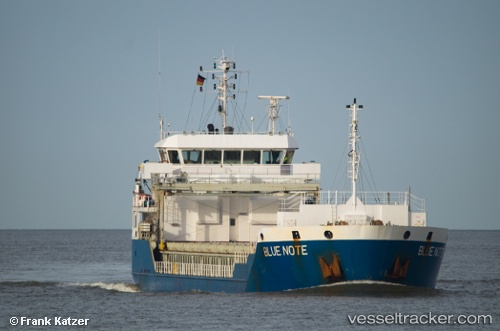
 Blue Note
Current Status
Where is the vessel?
Blue Note is currently in Near Casablanca, based on AIS data received about 1h ago.
Latest AIS update:
Current position: 33.66722° N, 7.59932° W (Near Casablanca)
Average speed (last 7 days): Loading…
Average speed (last 30 days): Loading…
Vessel profile: Blue Note is a Multi Purpose Carrier with dimensions 89m x 16m.
This page combines live AIS, route history, probable destination signals, nearby traffic, and port activity for practical vessel monitoring.
The current position of vessel Blue Note is 33.66722 lat / -7.59932 lng. Updated: 2026-05-15 13:50:42 UTCNearest reference points:
- Near Mohammedia
- Near Jorf Lasfar
- 54 nm N of El Jadida
Currently sailing under the flag of Antigua Barbuda ![]()
Blue Note built in 2010 year
Deadweight:
5203 tDetails:
Live Vessel Blue Note Analytics (details, animations, etc.)
Recent AIS points (UTC):
2026-05-15 10:05:36 UTC · 33.66732, -7.59906 · SOG 0.1 kn · COG 338°2026-05-15 11:47:38 UTC · 33.66721, -7.59912 · SOG 0.2 kn · COG 342°
2026-05-15 13:05:36 UTC · 33.66715, -7.59956 · SOG 0 kn · COG 9°
2026-05-15 13:50:42 UTC · 33.66722, -7.59932 · SOG 0.2 kn · COG 355°