 vesseltracker.com
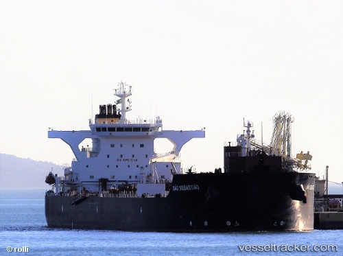
Sao Sebastiao
Current StatusWhere is the vessel?
Sao Sebastiao is currently in Near Santo Estevao, based on AIS data received less than 1h ago.
Latest AIS update:
Current position: 12.75351° S, 38.62497° W (Near Santo Estevao)
Average speed (last 7 days): Loading…
Average speed (last 30 days): Loading…
Vessel profile: Sao Sebastiao is a Crude Oil Tanker with dimensions 42m x 245m.
This page combines live AIS, route history, probable destination signals, nearby traffic, and port activity for practical vessel monitoring.
The current position of vessel Sao Sebastiao is -12.75351 lat / -38.62497 lng. Updated: 2026-05-16 11:37:05 UTCNearest reference points:
- Near Aracaju
- Near Barra dos Coqueiros
Details:
Live Vessel Sao Sebastiao Analytics (details, animations, etc.)
Recent AIS points (UTC):
2026-05-16 08:01:05 UTC · -12.75350, -38.62500 · SOG 0 kn · COG 119°2026-05-16 10:04:05 UTC · -12.75353, -38.62499 · SOG 0 kn · COG 119°
2026-05-16 10:46:05 UTC · -12.75352, -38.62500 · SOG 0 kn · COG 119°
2026-05-16 11:37:05 UTC · -12.75351, -38.62497 · SOG 0 kn · COG 119°