 vesseltracker.com
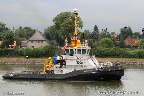
 Multratug 18
Current Status
Where is the vessel?
Multratug 18 is currently in Near Terneuzen, based on AIS data received less than 1h ago.
Latest AIS update:
Current position: 51.33931° N, 3.81632° E (Near Terneuzen)
Average speed (last 7 days): Loading…
Average speed (last 30 days): Loading…
Vessel profile: Multratug 18 is a [tug.fire_fighting_tug] with dimensions 36m x 12m.
This page combines live AIS, route history, probable destination signals, nearby traffic, and port activity for practical vessel monitoring.
The current position of vessel Multratug 18 is 51.33931 lat / 3.81632 lng. Updated: 2026-05-14 08:25:26 UTCNearest reference points:
- Near Terneuzen
- Near SLUISKIL
- Near Everingen
Currently sailing under the flag of Netherlands ![]()
Multratug 18 built in 2009 year
Details:
Live Vessel Multratug 18 Analytics (details, animations, etc.)
Recent AIS points (UTC):
2026-05-14 04:34:43 UTC · 51.33939, 3.81631 · SOG 0 kn · COG 343°2026-05-14 05:45:45 UTC · 51.33930, 3.81632 · SOG 0 kn · COG 343°
2026-05-14 08:00:05 UTC · 51.33940, 3.81631 · SOG 0 kn · COG 343°
2026-05-14 08:25:26 UTC · 51.33931, 3.81632 · SOG 0 kn · COG 343°