 vesseltracker.com
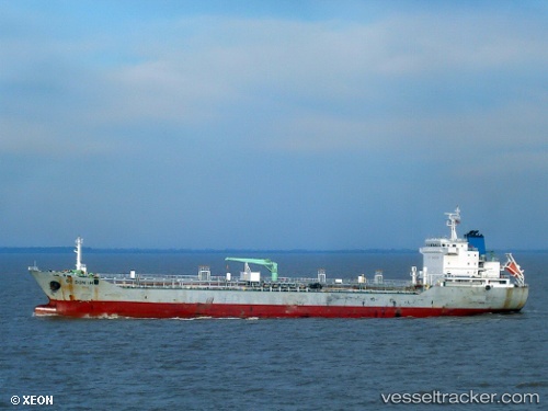
 INFINITY
Current Status
Where is the vessel?
INFINITY is currently in 79 nm E of Dabo, Singkep Isl, based on AIS data received about 4h ago.
Latest AIS update:
Current position: 0.31167° S, 105.84667° E (79 nm E of Dabo, Singkep Isl)
Average speed (last 7 days): Loading…
Average speed (last 30 days): Loading…
Vessel profile: INFINITY is a Chemical/Oil Products Tanker with dimensions 152m x 23m.
This page combines live AIS, route history, probable destination signals, nearby traffic, and port activity for practical vessel monitoring.
The current position of vessel INFINITY is -0.31167 lat / 105.84667 lng. Updated: 2026-05-14 23:39:04 UTCNearest reference points:
- 69 nm NE of Exspan
- 16 nm E of Tanjung Uban
- 16 nm E of Kualamandah
Currently sailing under the flag of Indonesia ![]()
INFINITY built in 2009 year
Deadweight:
17777 tDetails:
Live Vessel INFINITY Analytics (details, animations, etc.)
Recent AIS points (UTC):
2026-05-14 20:15:02 UTC · -0.78167, 106.11333 · SOG 9 kn · COG -1°2026-05-14 22:12:03 UTC · -0.51667, 105.95167 · SOG 9 kn · COG -1°
2026-05-14 22:27:02 UTC · -0.48167, 105.93167 · SOG 9 kn · COG -1°
2026-05-14 23:39:04 UTC · -0.31167, 105.84667 · SOG 9 kn · COG -1°