 vesseltracker.com
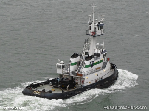
 Bohemia
Current Status
Where is the vessel?
Bohemia is currently in Near Nahant, based on AIS data received about 1h ago.
Latest AIS update:
Current position: 42.35677° N, 70.93014° W (Near Nahant)
Average speed (last 7 days): Loading…
Average speed (last 30 days): Loading…
Vessel profile: Bohemia is a Tug with dimensions 33m x 11m.
This page combines live AIS, route history, probable destination signals, nearby traffic, and port activity for practical vessel monitoring.
The current position of vessel Bohemia is 42.35677 lat / -70.93014 lng. Updated: 2026-05-14 11:26:42 UTCNearest reference points:
- Near Cohasset
- Near Kittery
- Near NEW BEDFORD
Currently sailing under the flag of USA ![]()
Bohemia built in 2008 year
Deadweight:
189 tDetails:
Live Vessel Bohemia Analytics (details, animations, etc.)
Recent AIS points (UTC):
2026-05-14 08:00:04 UTC · 42.08921, -70.51517 · SOG 8.1 kn · COG 347°2026-05-14 10:23:48 UTC · 42.34904, -70.76024 · SOG 8.2 kn · COG 304°
2026-05-14 10:30:34 UTC · 42.35864, -70.77692 · SOG 8.2 kn · COG 307°
2026-05-14 11:26:42 UTC · 42.35677, -70.93014 · SOG 8.4 kn · COG 205°