 vesseltracker.com
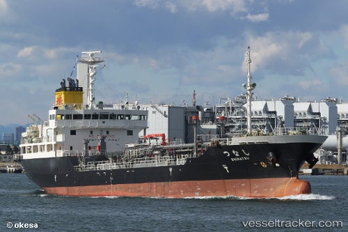
 Shinatsu
Current Status
Where is the vessel?
Shinatsu is currently in Near Agui Aichi, based on AIS data received less than 1h ago.
Latest AIS update:
Current position: 34.97818° N, 136.83492° E (Near Agui Aichi)
Average speed (last 7 days): Loading…
Average speed (last 30 days): Loading…
Vessel profile: Shinatsu is a Oil Products Tanker with dimensions 99m x 16m.
This page combines live AIS, route history, probable destination signals, nearby traffic, and port activity for practical vessel monitoring.
The current position of vessel Shinatsu is 34.97818 lat / 136.83492 lng. Updated: 2026-05-14 06:29:49 UTCNearest reference points:
- Near Yokkaichi
- Near Nagoya
- Near Kinuura
Currently sailing under the flag of Japan ![]()
Details:
Live Vessel Shinatsu Analytics (details, animations, etc.)
Recent AIS points (UTC):
2026-05-14 01:47:15 UTC · 34.97818, 136.83546 · SOG 0 kn · COG 300°2026-05-14 03:38:16 UTC · 34.97816, 136.83548 · SOG 0 kn · COG 300°
2026-05-14 04:26:15 UTC · 34.97817, 136.83549 · SOG 0 kn · COG 300°
2026-05-14 06:29:49 UTC · 34.97818, 136.83492 · SOG 0.9 kn · COG 299°