 vesseltracker.com
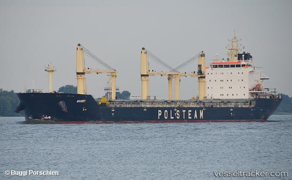
 Mamry
Mamry
Current Status
Where is the vessel?
Mamry is currently in Near Slieveroe, based on AIS data received about 1h ago.
Latest AIS update:
Current position: 52.26780° N, 7.02917° W (Near Slieveroe)
Average speed (last 7 days): Loading…
Average speed (last 30 days): Loading…
Vessel profile: Mamry is a Bulk Carrier with dimensions 190m x 190m.
This page combines live AIS, route history, probable destination signals, nearby traffic, and port activity for practical vessel monitoring.
The current position of vessel Mamry is 52.26780 lat / -7.02917 lng. Updated: 2026-05-17 16:22:42 UTCNearest reference points:
- Near HELVICK
- Near WEXFORD
- Near ARKLOW
Currently sailing under the flag of Bahamas ![]()
Mamry built in 2012 year
Deadweight:
30206 tDetails:
Live Vessel Mamry Analytics (details, animations, etc.)
Recent AIS points (UTC):
2026-05-17 14:02:11 UTC · 52.26782, -7.02920 · SOG 0 kn · COG 38°2026-05-17 14:06:51 UTC · 52.26783, -7.02919 · SOG 0 kn · COG 38°
2026-05-17 16:08:51 UTC · 52.26782, -7.02919 · SOG 0 kn · COG 38°
2026-05-17 16:22:42 UTC · 52.26780, -7.02917 · SOG 0 kn · COG 38°