 vesseltracker.com
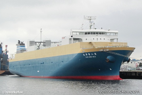
 No2 Toyomaru
Current Status
Where is the vessel?
No2 Toyomaru is currently in Near CHIBA, based on AIS data received less than 1h ago.
Latest AIS update:
Current position: 35.61117° N, 140.08524° E (Near CHIBA)
Average speed (last 7 days): Loading…
Average speed (last 30 days): Loading…
Vessel profile: No2 Toyomaru is a Vehicles Carrier with dimensions 124m x 20m.
This page combines live AIS, route history, probable destination signals, nearby traffic, and port activity for practical vessel monitoring.
The current position of vessel No2 Toyomaru is 35.61117 lat / 140.08524 lng. Updated: 2026-05-15 03:25:34 UTCNearest reference points:
- Near ANEGASAKI
- Near Aomi
- Near Kawasaki
Currently sailing under the flag of Japan ![]()
No2 Toyomaru built in 2009 year
Deadweight:
3605 tDetails:
Live Vessel No2 Toyomaru Analytics (details, animations, etc.)
Recent AIS points (UTC):
2026-05-14 21:45:41 UTC · 35.57677, 140.03951 · SOG 10.7 kn · COG 57°2026-05-14 22:19:43 UTC · 35.61118, 140.08524 · SOG 0 kn · COG 140°
2026-05-14 23:37:32 UTC · 35.61114, 140.08524 · SOG 0 kn · COG 140°
2026-05-15 03:25:34 UTC · 35.61117, 140.08524 · SOG 0 kn · COG 140°