 vesseltracker.com
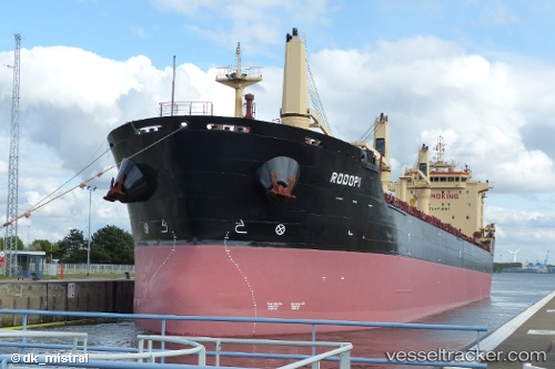
Rodopi
Current StatusWhere is the vessel?
Rodopi is currently in 15 nm S of PORTOPALO, based on AIS data received less than 1h ago.
Latest AIS update:
Current position: 36.41583° N, 15.17158° E (15 nm S of PORTOPALO)
Average speed (last 7 days): Loading…
Average speed (last 30 days): Loading…
Vessel profile: Rodopi is a Bulk Carrier with dimensions 24m x 186m.
This page combines live AIS, route history, probable destination signals, nearby traffic, and port activity for practical vessel monitoring.
The current position of vessel Rodopi is 36.41583 lat / 15.17158 lng. Updated: 2026-05-15 17:52:37 UTCNearest reference points:
- Near PORTOPALO
- 13 nm E of Il-Kappara
- Near Siracusa
Details:
Live Vessel Rodopi Analytics (details, animations, etc.)
Recent AIS points (UTC):
2026-05-15 13:26:21 UTC · 36.36999, 16.06808 · SOG 9.9 kn · COG 268°2026-05-15 15:34:46 UTC · 36.39234, 15.62787 · SOG 9.8 kn · COG 276°
2026-05-15 16:41:27 UTC · 36.40364, 15.41382 · SOG 9.1 kn · COG 276°
2026-05-15 17:52:37 UTC · 36.41583, 15.17158 · SOG 10 kn · COG 273°