 vesseltracker.com
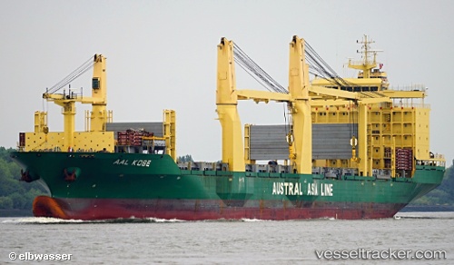
 Aal Kobe
Current Status
Where is the vessel?
Aal Kobe is currently in Near Tips Container Terminal, based on AIS data received about 3d ago.
Latest AIS update:
Current position: 13.04573° N, 100.83387° E (Near Tips Container Terminal)
Average speed (last 7 days): Loading…
Average speed (last 30 days): Loading…
Vessel profile: Aal Kobe is a Multi Purpose Carrier with dimensions 194m x 29m.
This page combines live AIS, route history, probable destination signals, nearby traffic, and port activity for practical vessel monitoring.
The current position of vessel Aal Kobe is 13.04573 lat / 100.83387 lng. Updated: 2026-04-28 08:57:58 UTCNearest reference points:
- Near Tips Container Terminal
- Near Sriracha
- Near SIRACHA
Currently sailing under the flag of Liberia ![]()
Aal Kobe built in 2012 year
Deadweight:
32043 tDetails:
Live Vessel Aal Kobe Analytics (details, animations, etc.)
Recent AIS points (UTC):
2026-04-28 08:57:58 UTC · 13.04573, 100.83387 · SOG 0.1 kn · COG 198°2026-04-28 08:57:58 UTC · 13.04573, 100.83387 · SOG 0.1 kn · COG 198°
2026-04-28 08:57:58 UTC · 13.04573, 100.83387 · SOG 0.1 kn · COG 198°
2026-04-28 08:57:58 UTC · 13.04573, 100.83387 · SOG 0.1 kn · COG 198°