 vesseltracker.com
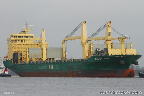
 Aal Dalian
Current Status
Where is the vessel?
Aal Dalian is currently in Near Panama, based on AIS data received about 4h ago.
Latest AIS update:
Current position: 8.86147° N, 79.51716° W (Near Panama)
Average speed (last 7 days): Loading…
Average speed (last 30 days): Loading…
Vessel profile: Aal Dalian is a Multi Purpose Carrier with dimensions 193m x 28m.
This page combines live AIS, route history, probable destination signals, nearby traffic, and port activity for practical vessel monitoring.
The current position of vessel Aal Dalian is 8.86147 lat / -79.51716 lng. Updated: 2026-05-14 23:34:36 UTCNearest reference points:
- Near Panama
- Near El Chorrillo
- Near Melones
Currently sailing under the flag of Liberia ![]()
Aal Dalian built in 2013 year
Deadweight:
31000 tDetails:
Live Vessel Aal Dalian Analytics (details, animations, etc.)
Recent AIS points (UTC):
2026-05-14 19:44:26 UTC · 8.86155, -79.51698 · SOG 0 kn · COG -1°2026-05-14 21:47:56 UTC · 8.86152, -79.51716 · SOG 0 kn · COG -1°
2026-05-14 23:10:08 UTC · 8.86149, -79.51713 · SOG 0.1 kn · COG -1°
2026-05-14 23:34:36 UTC · 8.86147, -79.51716 · SOG 0.1 kn · COG 93°