 vesseltracker.com
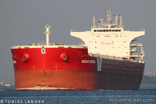
 NEFELI C
Current Status
Where is the vessel?
NEFELI C is currently in 66 nm N of Belitung, based on AIS data received less than 1h ago.
Latest AIS update:
Current position: 1.77833° S, 108.23333° E (66 nm N of Belitung)
Average speed (last 7 days): Loading…
Average speed (last 30 days): Loading…
Vessel profile: NEFELI C is a Bulk Carrier with dimensions 37m x 229m.
This page combines live AIS, route history, probable destination signals, nearby traffic, and port activity for practical vessel monitoring.
The current position of vessel NEFELI C is -1.77833 lat / 108.23333 lng. Updated: 2026-05-15 13:57:31 UTCNearest reference points:
- 74 nm N of Belitung
- 62 nm NE of Belitung
- 81 nm N of Belitung
Currently sailing under the flag of Liberia ![]()
NEFELI C built in 2013 year
Deadweight:
93076 tDetails:
Live Vessel NEFELI C Analytics (details, animations, etc.)
Recent AIS points (UTC):
2026-05-15 11:00:34 UTC · -2.05833, 108.59667 · SOG 9 kn · COG -1°2026-05-15 11:30:35 UTC · -2.03167, 108.52167 · SOG 9 kn · COG -1°
2026-05-15 12:57:34 UTC · -1.89167, 108.34167 · SOG 9 kn · COG -1°
2026-05-15 13:57:31 UTC · -1.77833, 108.23333 · SOG 9 kn · COG -1°