 vesseltracker.com
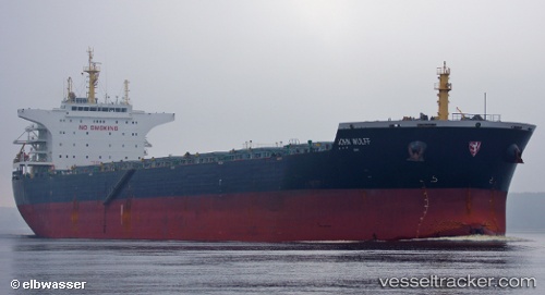
 THALIA
Current Status
Where is the vessel?
THALIA is currently in 139 nm SW of Port de Boké, based on AIS data received less than 1h ago.
Latest AIS update:
Current position: 9.06791° N, 16.54392° W (139 nm SW of Port de Boké)
Average speed (last 7 days): Loading…
Average speed (last 30 days): Loading…
Vessel profile: THALIA is a Bulk Carrier with dimensions m x m.
This page combines live AIS, route history, probable destination signals, nearby traffic, and port activity for practical vessel monitoring.
The current position of vessel THALIA is 9.06791 lat / -16.54392 lng. Updated: 2026-05-18 07:23:16 UTCNearest reference points:
- 97 nm SW of Port de Boké
- 144 nm SW of Bubaque
- 79 nm SW of Conakry
Currently sailing under the flag of Cyprus ![]()
Details:
Live Vessel THALIA Analytics (details, animations, etc.)
Recent AIS points (UTC):
2026-05-18 04:11:11 UTC · 9.54606, -16.91039 · SOG 11.2 kn · COG 143°2026-05-18 04:53:58 UTC · 9.43885, -16.82723 · SOG 11.4 kn · COG 142°
2026-05-18 05:48:46 UTC · 9.30575, -16.72111 · SOG 11 kn · COG 143°
2026-05-18 07:23:16 UTC · 9.06791, -16.54392 · SOG 11.5 kn · COG 144°