 vesseltracker.com
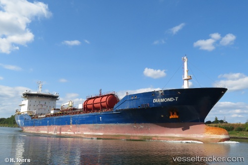
 JAY 2
JAY 2
Current Status
Where is the vessel?
JAY 2 is currently in 14 nm NW of Llanwrda, based on AIS data received about 1h ago.
Latest AIS update:
Current position: 52.14617° N, 3.61727° E (14 nm NW of Llanwrda)
Average speed (last 7 days): Loading…
Average speed (last 30 days): Loading…
Vessel profile: JAY 2 is a Chemical Oil Products Tanker with dimensions 170m x 25m.
This page combines live AIS, route history, probable destination signals, nearby traffic, and port activity for practical vessel monitoring.
The current position of vessel JAY 2 is 52.14617 lat / 3.61727 lng. Updated: 2026-05-14 11:35:55 UTCNearest reference points:
- 12 nm NE of Hunsdon
- Near Haarlemmermeer
- Near MAASVLAKTE - ROTTERDAM
Currently sailing under the flag of Marshall Islands ![]()
JAY 2 built in 2011 year
Deadweight:
26215 tDetails:
Live Vessel JAY 2 Analytics (details, animations, etc.)
Recent AIS points (UTC):
2026-05-14 08:23:58 UTC · 52.14336, 3.61457 · SOG 0.2 kn · COG 22°2026-05-14 10:11:58 UTC · 52.14397, 3.61708 · SOG 0.5 kn · COG 335°
2026-05-14 10:41:58 UTC · 52.14522, 3.61782 · SOG 0.1 kn · COG 270°
2026-05-14 11:35:55 UTC · 52.14617, 3.61727 · SOG 0.1 kn · COG 263°