 vesseltracker.com
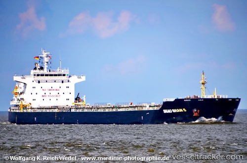
 VINCA
VINCA
Current Status
Where is the vessel?
VINCA is currently in 53 nm SE of Lü-hua Shan, based on AIS data received less than 1h ago.
Latest AIS update:
Current position: 30.41444° N, 123.52940° E (53 nm SE of Lü-hua Shan)
Average speed (last 7 days): Loading…
Average speed (last 30 days): Loading…
Vessel profile: VINCA is a Bulk Carrier with dimensions m x m.
This page combines live AIS, route history, probable destination signals, nearby traffic, and port activity for practical vessel monitoring.
The current position of vessel VINCA is 30.41444 lat / 123.52940 lng. Updated: 2026-04-24 13:02:38 UTCNearest reference points:
- 46 nm SE of Lü-hua Shan
- 51 nm SE of Lü-hua Shan
- 49 nm E of Lü-hua Shan
Currently sailing under the flag of Marshall Islands ![]()
Details:
Live Vessel VINCA Analytics (details, animations, etc.)
Recent AIS points (UTC):
2026-04-24 10:00:29 UTC · 31.02932, 123.41124 · SOG 12.3 kn · COG 184°2026-04-24 10:53:58 UTC · 30.85545, 123.45353 · SOG 12.5 kn · COG 169°
2026-04-24 12:23:09 UTC · 30.55314, 123.50732 · SOG 12.7 kn · COG 176°
2026-04-24 13:02:38 UTC · 30.41444, 123.52940 · SOG 12.7 kn · COG 171°