 vesseltracker.com
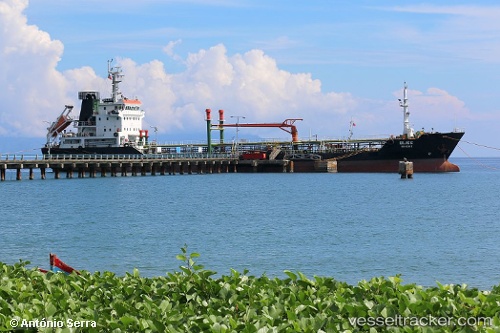
Bliss
Current StatusWhere is the vessel?
Bliss is currently in Near Pasir Panjang Wharves, based on AIS data received less than 1h ago.
Latest AIS update:
Current position: 1.23903° N, 103.79505° E (Near Pasir Panjang Wharves)
Average speed (last 7 days): Loading…
Average speed (last 30 days): Loading…
Vessel profile: Bliss is a Oil Products Tanker with dimensions 15m x 100m.
This page combines live AIS, route history, probable destination signals, nearby traffic, and port activity for practical vessel monitoring.
The current position of vessel Bliss is 1.23903 lat / 103.79505 lng. Updated: 2026-05-17 09:58:06 UTCNearest reference points:
- Near Singapore
- Near Pasir Panjang Wharves
- Near Bukit Merah Estate
Details:
Live Vessel Bliss Analytics (details, animations, etc.)
Recent AIS points (UTC):
2026-05-17 07:52:53 UTC · 1.23937, 103.79615 · SOG 0.1 kn · COG 206°2026-05-17 08:24:08 UTC · 1.23833, 103.79500 · SOG 0 kn · COG -1°
2026-05-17 09:34:08 UTC · 1.23913, 103.79507 · SOG 0.1 kn · COG 131°
2026-05-17 09:58:06 UTC · 1.23903, 103.79505 · SOG 0 kn · COG 126°