 vesseltracker.com
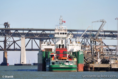
 Galveston
Current Status
Where is the vessel?
Galveston is currently in 60 nm SW of Offshore Ambrose, based on AIS data received about 2h ago.
Latest AIS update:
Current position: 39.39292° N, 72.77221° W (60 nm SW of Offshore Ambrose)
Average speed (last 7 days): Loading…
Average speed (last 30 days): Loading…
Vessel profile: Galveston is a Pusher Tug with dimensions 184m x 184m.
This page combines live AIS, route history, probable destination signals, nearby traffic, and port activity for practical vessel monitoring.
The current position of vessel Galveston is 39.39292 lat / -72.77221 lng. Updated: 2026-05-15 11:27:57 UTCNearest reference points:
- 13 nm E of Avon-by-the-Sea
- Near Manasquan
- Near Springville, Suffolk
Currently sailing under the flag of USA ![]()
Galveston built in 2008 year
Deadweight:
1485 tDetails:
Live Vessel Galveston Analytics (details, animations, etc.)
Recent AIS points (UTC):
2026-05-15 08:06:35 UTC · 39.52720, -72.44856 · SOG 5.1 kn · COG 245°2026-05-15 09:48:16 UTC · 39.46071, -72.61135 · SOG 5.1 kn · COG 246°
2026-05-15 10:54:28 UTC · 39.41167, -72.71500 · SOG 5 kn · COG -1°
2026-05-15 11:27:57 UTC · 39.39292, -72.77221 · SOG 5.1 kn · COG 255°