 vesseltracker.com
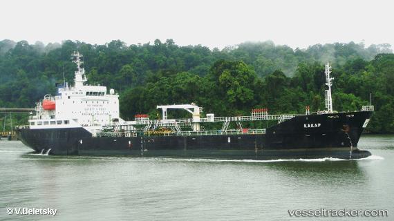
 Mt.kakap
Current Status
Where is the vessel?
Mt.kakap is currently in Near Bangkalan, based on AIS data received less than 1h ago.
Latest AIS update:
Current position: 6.93343° S, 112.71938° E (Near Bangkalan)
Average speed (last 7 days): Loading…
Average speed (last 30 days): Loading…
Vessel profile: Mt.kakap is a Oil Products Tanker with dimensions 108m x 18m.
This page combines live AIS, route history, probable destination signals, nearby traffic, and port activity for practical vessel monitoring.
The current position of vessel Mt.kakap is -6.93343 lat / 112.71938 lng. Updated: 2026-05-14 05:39:40 UTCNearest reference points:
- Near Bangkalan
- 11 nm W of Madura Terminal
- Near GRESIK
Currently sailing under the flag of Indonesia ![]()
Mt.kakap built in 2012 year
Deadweight:
6523 tDetails:
Live Vessel Mt.kakap Analytics (details, animations, etc.)
Recent AIS points (UTC):
2026-05-14 01:35:30 UTC · -6.79696, 113.03181 · SOG 11 kn · COG 258°2026-05-14 03:48:40 UTC · -6.84516, 112.81823 · SOG 0.3 kn · COG 134°
2026-05-14 04:52:00 UTC · -6.85669, 112.76996 · SOG 7.6 kn · COG 246°
2026-05-14 05:39:40 UTC · -6.93343, 112.71938 · SOG 8.1 kn · COG 200°