 vesseltracker.com
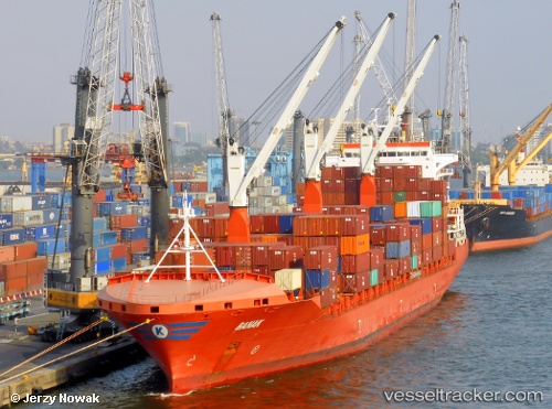
 Banak
Banak
Current Status
Where is the vessel?
Banak is currently in 39 nm NE of Famagusta, based on AIS data received less than 1h ago.
Latest AIS update:
Current position: 35.41493° N, 34.65067° E (39 nm NE of Famagusta)
Average speed (last 7 days): Loading…
Average speed (last 30 days): Loading…
Vessel profile: Banak is a Container Ship with dimensions 209m x 30m.
This page combines live AIS, route history, probable destination signals, nearby traffic, and port activity for practical vessel monitoring.
The current position of vessel Banak is 35.41493 lat / 34.65067 lng. Updated: 2026-05-15 14:00:51 UTCNearest reference points:
- Near Al Latakia
- Near Larnaca
- Near Al Ladhiqiyah
Currently sailing under the flag of Marshall Is ![]()
Banak built in 2014 year
Deadweight:
34200 tDetails:
Live Vessel Banak Analytics (details, animations, etc.)
Recent AIS points (UTC):
2026-05-15 10:27:51 UTC · 35.97943, 34.76967 · SOG 9.9 kn · COG 183°2026-05-15 11:42:02 UTC · 35.77807, 34.78638 · SOG 9.7 kn · COG 181°
2026-05-15 13:40:31 UTC · 35.46957, 34.67939 · SOG 10.6 kn · COG 206°
2026-05-15 14:00:51 UTC · 35.41493, 34.65067 · SOG 10.4 kn · COG 206°