 vesseltracker.com
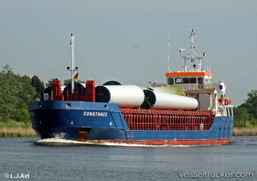
 Constance
Current Status
Where is the vessel?
Constance is currently in 25 nm S of Carchuna, based on AIS data received less than 1h ago.
Latest AIS update:
Current position: 36.30576° N, 3.26000° W (25 nm S of Carchuna)
Average speed (last 7 days): Loading…
Average speed (last 30 days): Loading…
Vessel profile: Constance is a Multi Purpose Carrier with dimensions 86m x 12m.
This page combines live AIS, route history, probable destination signals, nearby traffic, and port activity for practical vessel monitoring.
The current position of vessel Constance is 36.30576 lat / -3.26000 lng. Updated: 2026-05-16 01:53:56 UTCNearest reference points:
- 23 nm S of Carchuna
- 29 nm S of Carchuna
- Near MOTRIL
Currently sailing under the flag of Gibraltar ![]()
Constance built in 2011 year
Deadweight:
3196 tDetails:
Live Vessel Constance Analytics (details, animations, etc.)
Recent AIS points (UTC):
2026-05-15 21:26:20 UTC · 36.40952, -2.41583 · SOG 8.1 kn · COG 263°2026-05-15 22:43:48 UTC · 36.38171, -2.64247 · SOG 9.2 kn · COG 263°
2026-05-15 23:44:07 UTC · 36.35823, -2.83368 · SOG 9.3 kn · COG 261°
2026-05-16 01:53:56 UTC · 36.30576, -3.26000 · SOG 9.7 kn · COG 260°