 vesseltracker.com
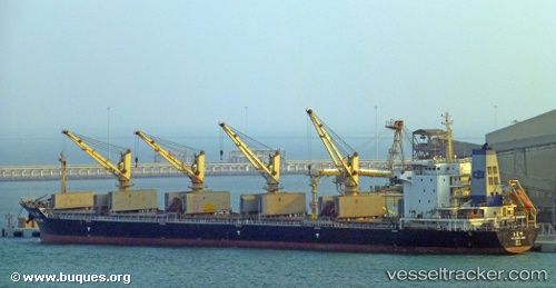
 Yu Long Ling
Current Status
Where is the vessel?
Yu Long Ling is currently in 199 nm SE of Diego Garcia, based on AIS data received less than 1h ago.
Latest AIS update:
Current position: 10.14667° S, 74.21667° E (199 nm SE of Diego Garcia)
Average speed (last 7 days): Loading…
Average speed (last 30 days): Loading…
Vessel profile: Yu Long Ling is a Bulk Carrier with dimensions 177m x 28m.
This page combines live AIS, route history, probable destination signals, nearby traffic, and port activity for practical vessel monitoring.
The current position of vessel Yu Long Ling is -10.14667 lat / 74.21667 lng. Updated: 2026-05-15 20:22:06 UTCNearest reference points:
- 253 nm S of Diego Garcia
- 263 nm S of Diego Garcia
Currently sailing under the flag of China ![]()
Yu Long Ling built in 2011 year
Deadweight:
32005 tDetails:
Live Vessel Yu Long Ling Analytics (details, animations, etc.)
Recent AIS points (UTC):
2026-05-15 16:04:52 UTC · -9.70953, 74.82045 · SOG 10 kn · COG 234°2026-05-15 17:57:31 UTC · -9.89670, 74.55903 · SOG 10.1 kn · COG 231°
2026-05-15 19:28:49 UTC · -10.05340, 74.34098 · SOG 10.3 kn · COG 233°
2026-05-15 20:22:06 UTC · -10.14667, 74.21667 · SOG 10 kn · COG -1°