 vesseltracker.com
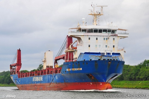
Ocean Freedom
Current StatusWhere is the vessel?
Ocean Freedom is currently in 64 nm S of Ben Slimane, based on AIS data received about 2h ago.
Latest AIS update:
Current position: 32.58500° N, 70.81167° W (64 nm S of Ben Slimane)
Average speed (last 7 days): Loading…
Average speed (last 30 days): Loading…
Vessel profile: Ocean Freedom is a Heavy Load Carrier with dimensions 24m x 153m.
This page combines live AIS, route history, probable destination signals, nearby traffic, and port activity for practical vessel monitoring.
The current position of vessel Ocean Freedom is 32.58500 lat / -70.81167 lng. Updated: 2026-04-15 11:26:00 UTCNearest reference points:
- 150 nm S of Ben Slimane
Details:
Live Vessel Ocean Freedom Analytics (details, animations, etc.)
Recent AIS points (UTC):
2026-04-15 06:02:02 UTC · 33.51833, -69.90167 · SOG 13 kn · COG -1°2026-04-15 08:29:02 UTC · 33.10333, -70.31500 · SOG 13 kn · COG -1°
2026-04-15 09:59:02 UTC · 32.84833, -70.56167 · SOG 13 kn · COG -1°
2026-04-15 11:26:00 UTC · 32.58500, -70.81167 · SOG 13 kn · COG -1°