 vesseltracker.com
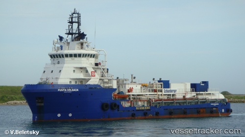
Punta Delgada
Current StatusWhere is the vessel?
Punta Delgada is currently in Near Yùum K'Ak'Náab, based on AIS data received less than 1h ago.
Latest AIS update:
Current position: 19.60836° N, 92.24738° W (Near Yùum K'Ak'Náab)
Average speed (last 7 days): Loading…
Average speed (last 30 days): Loading…
Vessel profile: Punta Delgada is a Offshore Tug Supply Ship with dimensions 16m x 73m.
This page combines live AIS, route history, probable destination signals, nearby traffic, and port activity for practical vessel monitoring.
The current position of vessel Punta Delgada is 19.60836 lat / -92.24738 lng. Updated: 2026-04-24 19:42:05 UTCNearest reference points:
- Near Yùum K'Ak'Náab
- 18 nm S of Yùum K'Ak'Náab
- 35 nm S of Yùum K'Ak'Náab
Details:
Live Vessel Punta Delgada Analytics (details, animations, etc.)
Recent AIS points (UTC):
2026-04-24 16:20:22 UTC · 19.61167, -92.24166 · SOG 0 kn · COG -1°2026-04-24 17:53:55 UTC · 19.61293, -92.24223 · SOG 0.2 kn · COG 136°
2026-04-24 19:23:36 UTC · 19.60940, -92.24626 · SOG 0.3 kn · COG 137°
2026-04-24 19:42:05 UTC · 19.60836, -92.24738 · SOG 0.4 kn · COG 136°