 vesseltracker.com
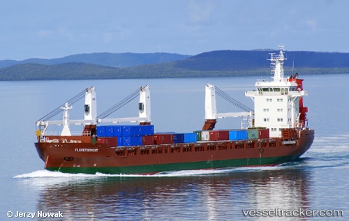
 FLORETGRACHT
Current Status
Where is the vessel?
FLORETGRACHT is currently in Near BANGOR, based on AIS data received about 2h ago.
Latest AIS update:
Current position: 54.68562° N, 5.68744° W (Near BANGOR)
Average speed (last 7 days): Loading…
Average speed (last 30 days): Loading…
Vessel profile: FLORETGRACHT is a General Cargo Ship with dimensions m x m.
This page combines live AIS, route history, probable destination signals, nearby traffic, and port activity for practical vessel monitoring.
The current position of vessel FLORETGRACHT is 54.68562 lat / -5.68744 lng. Updated: 2026-05-13 19:39:57 UTCNearest reference points:
- Near Belfast
- Near Crossgar
- Near Southend
Currently sailing under the flag of Netherlands ![]()
FLORETGRACHT built in 2012 year
Deadweight:
12067 tDetails:
Live Vessel FLORETGRACHT Analytics (details, animations, etc.)
Recent AIS points (UTC):
2026-05-13 16:24:20 UTC · 54.68561, -5.68790 · SOG 0.4 kn · COG 330°2026-05-13 18:07:53 UTC · 54.68559, -5.68753 · SOG 0.5 kn · COG 346°
2026-05-13 19:03:35 UTC · 54.68577, -5.68686 · SOG 0.2 kn · COG 321°
2026-05-13 19:39:57 UTC · 54.68562, -5.68744 · SOG 0.2 kn · COG 334°