 vesseltracker.com
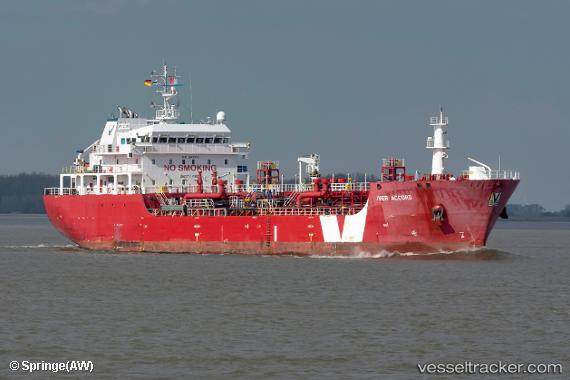
 IVER ACCORD
Current Status
Where is the vessel?
IVER ACCORD is currently in Near Vridi, based on AIS data received less than 1h ago.
Latest AIS update:
Current position: 5.22290° N, 4.03306° W (Near Vridi)
Average speed (last 7 days): Loading…
Average speed (last 30 days): Loading…
Vessel profile: IVER ACCORD is a Bitumen Tanker with dimensions 99m x 18m.
This page combines live AIS, route history, probable destination signals, nearby traffic, and port activity for practical vessel monitoring.
The current position of vessel IVER ACCORD is 5.22290 lat / -4.03306 lng. Updated: 2026-05-15 05:58:18 UTCNearest reference points:
- Near Vridi
- Near Abidjan
- Near Espoir
Currently sailing under the flag of Madeira ![]()
IVER ACCORD built in 2010 year
Deadweight:
5897 tDetails:
Live Vessel IVER ACCORD Analytics (details, animations, etc.)
Recent AIS points (UTC):
2026-05-15 01:13:11 UTC · 5.22297, -4.03316 · SOG 0.2 kn · COG 219°2026-05-15 03:46:16 UTC · 5.22308, -4.03338 · SOG 0.1 kn · COG 209°
2026-05-15 05:06:03 UTC · 5.22312, -4.03367 · SOG 0.2 kn · COG 192°
2026-05-15 05:58:18 UTC · 5.22290, -4.03306 · SOG 0.4 kn · COG 227°