 vesseltracker.com
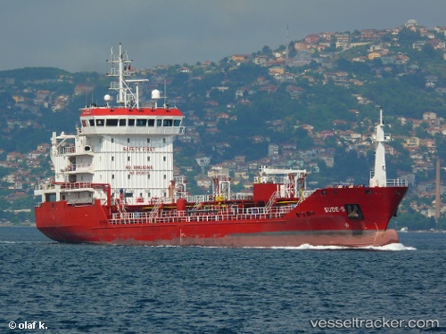
 SUDE S
Current Status
Where is the vessel?
SUDE S is currently in Near Porto Grande, based on AIS data received less than 1h ago.
Latest AIS update:
Current position: 16.88978° N, 25.00337° W (Near Porto Grande)
Average speed (last 7 days): Loading…
Average speed (last 30 days): Loading…
Vessel profile: SUDE S is a Oil/Chemical Tanker with dimensions m x m.
This page combines live AIS, route history, probable destination signals, nearby traffic, and port activity for practical vessel monitoring.
The current position of vessel SUDE S is 16.88978 lat / -25.00337 lng. Updated: 2026-05-14 08:02:14 UTCNearest reference points:
- 39 nm W of Ilha do Sal
- 100 nm N of Porto Grande
- 102 nm N of Porto Grande
Currently sailing under the flag of Cabo Verde ![]()
Details:
Live Vessel SUDE S Analytics (details, animations, etc.)
Recent AIS points (UTC):
2026-05-14 04:20:13 UTC · 16.88973, -25.00327 · SOG 0.2 kn · COG 47°2026-05-14 05:52:56 UTC · 16.88972, -25.00322 · SOG 0.2 kn · COG 37°
2026-05-14 07:40:54 UTC · 16.88974, -25.00324 · SOG 0 kn · COG 38°
2026-05-14 08:02:14 UTC · 16.88978, -25.00337 · SOG 0.3 kn · COG 41°