 vesseltracker.com
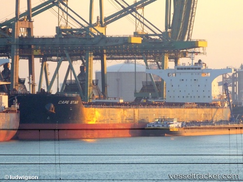
Cape Star
Current StatusWhere is the vessel?
Cape Star is currently in Near Choa Chu Kang, based on AIS data received less than 1h ago.
Latest AIS update:
Current position: 1.26914° N, 103.91109° E (Near Choa Chu Kang)
Average speed (last 7 days): Loading…
Average speed (last 30 days): Loading…
Vessel profile: Cape Star is a Bulk Carrier with dimensions 46m x 292m.
This page combines live AIS, route history, probable destination signals, nearby traffic, and port activity for practical vessel monitoring.
The current position of vessel Cape Star is 1.26914 lat / 103.91109 lng. Updated: 2026-04-28 15:53:34 UTCNearest reference points:
- Near Tampines
- Near Choa Chu Kang
- Near Changi
Details:
Live Vessel Cape Star Analytics (details, animations, etc.)
Recent AIS points (UTC):
2026-04-28 11:53:41 UTC · 1.26984, 103.90992 · SOG 0 kn · COG 70°2026-04-28 14:02:34 UTC · 1.26907, 103.91035 · SOG 0 kn · COG 48°
2026-04-28 14:08:38 UTC · 1.26907, 103.91036 · SOG 0 kn · COG 49°
2026-04-28 15:53:34 UTC · 1.26914, 103.91109 · SOG 0.2 kn · COG 57°