 vesseltracker.com
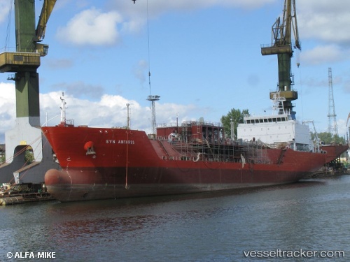
 Syn Antares
Current Status
Where is the vessel?
Syn Antares is currently in 64 nm NE of Boboras, based on AIS data received less than 1h ago.
Latest AIS update:
Current position: 47.25428° N, 7.14701° W (64 nm NE of Boboras)
Average speed (last 7 days): Loading…
Average speed (last 30 days): Loading…
Vessel profile: Syn Antares is a Lpg Tanker with dimensions 123m x 19m.
This page combines live AIS, route history, probable destination signals, nearby traffic, and port activity for practical vessel monitoring.
The current position of vessel Syn Antares is 47.25428 lat / -7.14701 lng. Updated: 2026-05-16 05:50:18 UTCNearest reference points:
- 58 nm SE of Rietheim-Weilheim
- 60 nm SE of San Clodio
- 46 nm W of SEIN
Currently sailing under the flag of Italy ![]()
Syn Antares built in 2014 year
Deadweight:
8000 tDetails:
Live Vessel Syn Antares Analytics (details, animations, etc.)
Recent AIS points (UTC):
2026-05-16 02:28:18 UTC · 47.92667, -6.59333 · SOG 13 kn · COG -1°2026-05-16 03:28:20 UTC · 47.72500, -6.73500 · SOG 13 kn · COG -1°
2026-05-16 05:01:20 UTC · 47.41500, -6.99667 · SOG 13 kn · COG -1°
2026-05-16 05:50:18 UTC · 47.25428, -7.14701 · SOG 14.1 kn · COG 208°