 vesseltracker.com
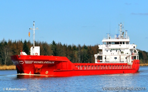
 Scheldedijk
Current Status
Where is the vessel?
Scheldedijk is currently in 12 nm E of Sant Jaume d'Enveja, based on AIS data received about 1h ago.
Latest AIS update:
Current position: 40.62957° N, 0.97101° E (12 nm E of Sant Jaume d'Enveja)
Average speed (last 7 days): Loading…
Average speed (last 30 days): Loading…
Vessel profile: Scheldedijk is a Multi Purpose Carrier with dimensions 90m x 14m.
This page combines live AIS, route history, probable destination signals, nearby traffic, and port activity for practical vessel monitoring.
The current position of vessel Scheldedijk is 40.62957 lat / 0.97101 lng. Updated: 2026-04-07 20:00:27 UTCNearest reference points:
- Near San Carlos de la Rápita
- Near CAMBRILS
- Near Salou
Currently sailing under the flag of Netherlands ![]()
Scheldedijk built in 2010 year
Deadweight:
4891 tDetails:
Live Vessel Scheldedijk Analytics (details, animations, etc.)
Recent AIS points (UTC):
2026-04-07 13:20:39 UTC · 39.71149, -0.03267 · SOG 10.6 kn · COG 55°2026-04-07 16:24:27 UTC · 40.14597, 0.40604 · SOG 11 kn · COG 35°
2026-04-07 17:53:28 UTC · 40.37018, 0.60850 · SOG 11 kn · COG 36°
2026-04-07 20:00:27 UTC · 40.62957, 0.97101 · SOG 10.6 kn · COG 48°