 vesseltracker.com
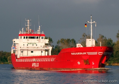
 Reggedijk
Current Status
Where is the vessel?
Reggedijk is currently in Near Gelibolu, based on AIS data received about 1h ago.
Latest AIS update:
Current position: 40.47311° N, 26.76765° E (Near Gelibolu)
Average speed (last 7 days): Loading…
Average speed (last 30 days): Loading…
Vessel profile: Reggedijk is a Multi Purpose Carrier with dimensions 90m x 14m.
This page combines live AIS, route history, probable destination signals, nearby traffic, and port activity for practical vessel monitoring.
The current position of vessel Reggedijk is 40.47311 lat / 26.76765 lng. Updated: 2026-04-30 17:59:17 UTCNearest reference points:
- Near Sarköy
- Near Gelibolu
- Near Dardanelles
Currently sailing under the flag of Netherlands ![]()
Reggedijk built in 2011 year
Deadweight:
4450 tDetails:
Live Vessel Reggedijk Analytics (details, animations, etc.)
Recent AIS points (UTC):
2026-04-30 14:02:16 UTC · 40.47309, 26.76759 · SOG 0.5 kn · COG 56°2026-04-30 16:14:11 UTC · 40.47348, 26.76750 · SOG 0.5 kn · COG 109°
2026-04-30 16:44:12 UTC · 40.47322, 26.76757 · SOG 0.5 kn · COG 61°
2026-04-30 17:59:17 UTC · 40.47311, 26.76765 · SOG 0.5 kn · COG 89°