 vesseltracker.com
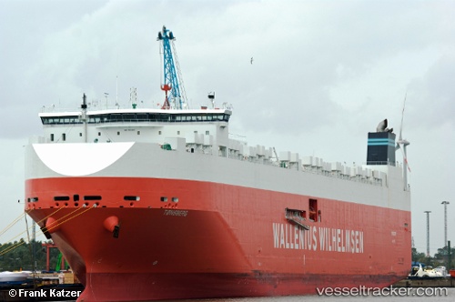
Tonsberg
Current StatusWhere is the vessel?
Tonsberg is currently in 124 nm NE of Achau, based on AIS data received less than 1h ago.
Latest AIS update:
Current position: 50.27803° N, 160.49339° W (124 nm NE of Achau)
Average speed (last 7 days): Loading…
Average speed (last 30 days): Loading…
Vessel profile: Tonsberg is a Vehicles Carrier with dimensions 32m x 265m.
This page combines live AIS, route history, probable destination signals, nearby traffic, and port activity for practical vessel monitoring.
The current position of vessel Tonsberg is 50.27803 lat / -160.49339 lng. Updated: 2026-05-14 18:00:10 UTCDetails:
Live Vessel Tonsberg Analytics (details, animations, etc.)
Recent AIS points (UTC):
2026-05-14 13:59:33 UTC · 50.05860, -162.30618 · SOG 17.4 kn · COG 78°2026-05-14 16:15:24 UTC · 50.18682, -161.29301 · SOG 17.9 kn · COG 77°
2026-05-14 16:24:45 UTC · 50.19617, -161.22182 · SOG 17.9 kn · COG 77°
2026-05-14 18:00:10 UTC · 50.27803, -160.49339 · SOG 18 kn · COG 81°