 vesseltracker.com
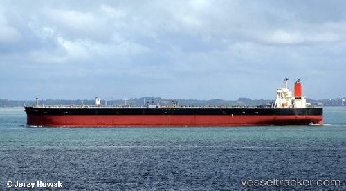
 LILA KOCHI
Current Status
Where is the vessel?
LILA KOCHI is currently in 51 nm W of Kumejima, based on AIS data received less than 1h ago.
Latest AIS update:
Current position: 26.19333° N, 125.78833° E (51 nm W of Kumejima)
Average speed (last 7 days): Loading…
Average speed (last 30 days): Loading…
Vessel profile: LILA KOCHI is a Tanker with dimensions m x m.
This page combines live AIS, route history, probable destination signals, nearby traffic, and port activity for practical vessel monitoring.
The current position of vessel LILA KOCHI is 26.19333 lat / 125.78833 lng. Updated: 2026-04-30 14:09:13 UTCNearest reference points:
- 120 nm NE of Nangang
- 77 nm SE of Miyakojima
Currently sailing under the flag of Liberia ![]()
Details:
Live Vessel LILA KOCHI Analytics (details, animations, etc.)
Recent AIS points (UTC):
2026-04-30 10:15:13 UTC · 25.70167, 125.13333 · SOG 11 kn · COG -1°2026-04-30 12:03:13 UTC · 25.93667, 125.43833 · SOG 11 kn · COG -1°
2026-04-30 13:00:16 UTC · 26.05500, 125.59833 · SOG 11 kn · COG -1°
2026-04-30 14:09:13 UTC · 26.19333, 125.78833 · SOG 11 kn · COG -1°