 vesseltracker.com
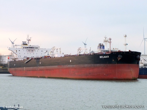
 Belmar
Current Status
Where is the vessel?
Belmar is currently in 80 nm W of Alozaina, based on AIS data received less than 1h ago.
Latest AIS update:
Current position: 36.53781° N, 16.48928° W (80 nm W of Alozaina)
Average speed (last 7 days): Loading…
Average speed (last 30 days): Loading…
Vessel profile: Belmar is a Crude Oil Tanker with dimensions 249m x 45m.
This page combines live AIS, route history, probable destination signals, nearby traffic, and port activity for practical vessel monitoring.
The current position of vessel Belmar is 36.53781 lat / -16.48928 lng. Updated: 2026-05-14 19:42:56 UTCNearest reference points:
- 78 nm W of Nedroma
Currently sailing under the flag of Malta ![]()
Belmar built in 2011 year
Deadweight:
115903 tDetails:
Live Vessel Belmar Analytics (details, animations, etc.)
Recent AIS points (UTC):
2026-05-14 16:29:06 UTC · 36.50446, -15.81641 · SOG 10.5 kn · COG 279°2026-05-14 18:03:36 UTC · 36.51981, -16.14998 · SOG 10.1 kn · COG 280°
2026-05-14 18:56:10 UTC · 36.52860, -16.33016 · SOG 9.8 kn · COG 282°
2026-05-14 19:42:56 UTC · 36.53781, -16.48928 · SOG 9.9 kn · COG 281°