 vesseltracker.com
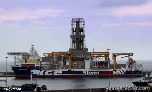
Stena Icemax
Current StatusWhere is the vessel?
Stena Icemax is currently in 41 nm NW of Bnei Darom, based on AIS data received about 1h ago.
Latest AIS update:
Current position: 32.08333° N, 30.94083° E (41 nm NW of Bnei Darom)
Average speed (last 7 days): Loading…
Average speed (last 30 days): Loading…
Vessel profile: Stena Icemax is a Drilling Ship with dimensions 42m x 228m.
This page combines live AIS, route history, probable destination signals, nearby traffic, and port activity for practical vessel monitoring.
The current position of vessel Stena Icemax is 32.08333 lat / 30.94083 lng. Updated: 2026-05-16 14:02:52 UTCNearest reference points:
- Near Damietta
- 21 nm N of Port Said
- Near Alexandria
Details:
Live Vessel Stena Icemax Analytics (details, animations, etc.)
Recent AIS points (UTC):
2026-05-16 11:04:30 UTC · 32.08317, 30.94083 · SOG 0 kn · COG 325°2026-05-16 11:53:21 UTC · 32.08317, 30.94083 · SOG 0 kn · COG 325°
2026-05-16 13:34:02 UTC · 32.08333, 30.94083 · SOG 0 kn · COG 325°
2026-05-16 14:02:52 UTC · 32.08333, 30.94083 · SOG 0 kn · COG 325°