 vesseltracker.com
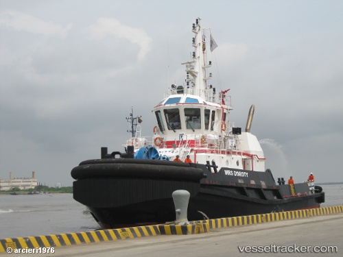
Mrs Doroty
Current StatusWhere is the vessel?
Mrs Doroty is currently in 35 nm S of Casilda, based on AIS data received less than 1h ago.
Latest AIS update:
Current position: 21.17667° N, 80.05333° W (35 nm S of Casilda)
Average speed (last 7 days): Loading…
Average speed (last 30 days): Loading…
Vessel profile: Mrs Doroty is a Tug with dimensions 12m x 32m.
This page combines live AIS, route history, probable destination signals, nearby traffic, and port activity for practical vessel monitoring.
The current position of vessel Mrs Doroty is 21.17667 lat / -80.05333 lng. Updated: 2026-05-14 19:36:20 UTCNearest reference points:
- Near Georgetown, Grand Cayman
- 28 nm NE of VARADERO
- 36 nm E of Cayo Coco
Details:
Live Vessel Mrs Doroty Analytics (details, animations, etc.)
Recent AIS points (UTC):
2026-05-14 16:48:20 UTC · 21.06167, -79.86666 · SOG 4 kn · COG -1°2026-05-14 18:03:24 UTC · 21.11167, -79.95333 · SOG 4 kn · COG -1°
2026-05-14 19:36:20 UTC · 21.17667, -80.05333 · SOG 4 kn · COG -1°
2026-05-14 19:36:20 UTC · 21.17667, -80.05333 · SOG 4 kn · COG -1°