 vesseltracker.com
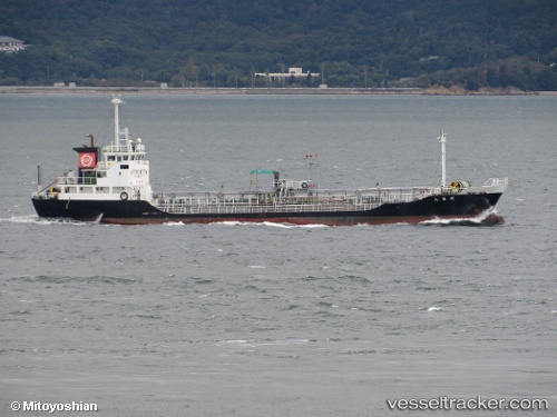
 Souryoumaru
Current Status
Where is the vessel?
Souryoumaru is currently in Near Shikokuchuo, based on AIS data received less than 1h ago.
Latest AIS update:
Current position: 34.09607° N, 133.55072° E (Near Shikokuchuo)
Average speed (last 7 days): Loading…
Average speed (last 30 days): Loading…
Vessel profile: Souryoumaru is a Chemical Tanker with dimensions 65m x 65m.
This page combines live AIS, route history, probable destination signals, nearby traffic, and port activity for practical vessel monitoring.
The current position of vessel Souryoumaru is 34.09607 lat / 133.55072 lng. Updated: 2026-05-14 00:03:29 UTCNearest reference points:
- Near FUKUYAMA
- Near MIZUSHIMA
- Near NYUGAWA
Currently sailing under the flag of Japan ![]()
Details:
Live Vessel Souryoumaru Analytics (details, animations, etc.)
Recent AIS points (UTC):
2026-05-13 19:59:59 UTC · 34.37122, 134.32965 · SOG 12.9 kn · COG 296°2026-05-13 21:23:42 UTC · 34.41820, 133.97177 · SOG 14.1 kn · COG 256°
2026-05-13 22:02:59 UTC · 34.37465, 133.80334 · SOG 13.6 kn · COG 255°
2026-05-14 00:03:29 UTC · 34.09607, 133.55072 · SOG 12.2 kn · COG 183°