 vesseltracker.com
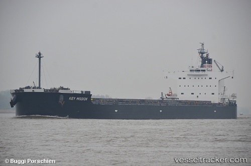
Blue Ridge
Current StatusWhere is the vessel?
Blue Ridge is currently in 43 nm S of Moorreesburg, based on AIS data received about 7d ago.
Latest AIS update:
Current position: 35.17500° S, 18.38167° E (43 nm S of Moorreesburg)
Average speed (last 7 days): Loading…
Average speed (last 30 days): Loading…
Vessel profile: Blue Ridge is a Bulk Carrier with dimensions 32m x 229m.
This page combines live AIS, route history, probable destination signals, nearby traffic, and port activity for practical vessel monitoring.
The current position of vessel Blue Ridge is -35.17500 lat / 18.38167 lng. Updated: 2026-03-25 09:24:02 UTCNearest reference points:
- 15 nm SE of Moorreesburg
- 18 nm SW of Cape Of Good Hope
- Near Mitchells Plain
Details:
Live Vessel Blue Ridge Analytics (details, animations, etc.)
Recent AIS points (UTC):
2026-03-25 07:41:20 UTC · -35.04554, 18.01551 · SOG 11.7 kn · COG 115°2026-03-25 09:24:02 UTC · -35.17500, 18.38167 · SOG 11 kn · COG -1°
2026-03-25 09:24:02 UTC · -35.17500, 18.38167 · SOG 11 kn · COG -1°
2026-03-25 09:24:02 UTC · -35.17500, 18.38167 · SOG 11 kn · COG -1°