 vesseltracker.com
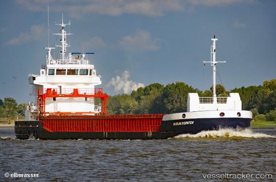
 MIA MARIA
Current Status
Where is the vessel?
MIA MARIA is currently in 18 nm W of Braevig, based on AIS data received less than 1h ago.
Latest AIS update:
Current position: 56.25627° N, 7.30481° W (18 nm W of Braevig)
Average speed (last 7 days): Loading…
Average speed (last 30 days): Loading…
Vessel profile: MIA MARIA is a General Cargo with dimensions m x m.
This page combines live AIS, route history, probable destination signals, nearby traffic, and port activity for practical vessel monitoring.
The current position of vessel MIA MARIA is 56.25627 lat / -7.30481 lng. Updated: 2026-05-14 23:49:11 UTCNearest reference points:
- Near Fishnish, Isle of Mull
- Near CRAIGNURE PIER
- Near North Harris
Details:
Live Vessel MIA MARIA Analytics (details, animations, etc.)
Recent AIS points (UTC):
2026-05-14 19:51:53 UTC · 56.91758, -7.12489 · SOG 10.4 kn · COG 188°2026-05-14 22:24:02 UTC · 56.49374, -7.28638 · SOG 10.7 kn · COG 184°
2026-05-14 22:58:51 UTC · 56.39136, -7.30717 · SOG 10.2 kn · COG 179°
2026-05-14 23:49:11 UTC · 56.25627, -7.30481 · SOG 8.9 kn · COG 156°