 vesseltracker.com
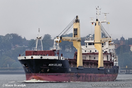
 Msm Dolores
Current Status
Where is the vessel?
Msm Dolores is currently in Near Cape Lopez, based on AIS data received about 1h ago.
Latest AIS update:
Current position: 0.55836° S, 8.59782° E (Near Cape Lopez)
Average speed (last 7 days): Loading…
Average speed (last 30 days): Loading…
Vessel profile: Msm Dolores is a Multi Purpose Carrier with dimensions 110m x 110m.
This page combines live AIS, route history, probable destination signals, nearby traffic, and port activity for practical vessel monitoring.
The current position of vessel Msm Dolores is -0.55836 lat / 8.59782 lng. Updated: 2026-05-13 23:39:29 UTCNearest reference points:
- Near Cape Lopez
- Near Port Gentil
Currently sailing under the flag of Cyprus ![]()
Msm Dolores built in 2012 year
Deadweight:
5746 tDetails:
Live Vessel Msm Dolores Analytics (details, animations, etc.)
Recent AIS points (UTC):
2026-05-13 19:57:25 UTC · -0.69049, 8.77497 · SOG 0 kn · COG 16°2026-05-13 21:53:26 UTC · -0.57509, 8.82328 · SOG 7.9 kn · COG 345°
2026-05-13 22:59:35 UTC · -0.55912, 8.68899 · SOG 8.2 kn · COG 267°
2026-05-13 23:39:29 UTC · -0.55836, 8.59782 · SOG 8.2 kn · COG 267°