 vesseltracker.com
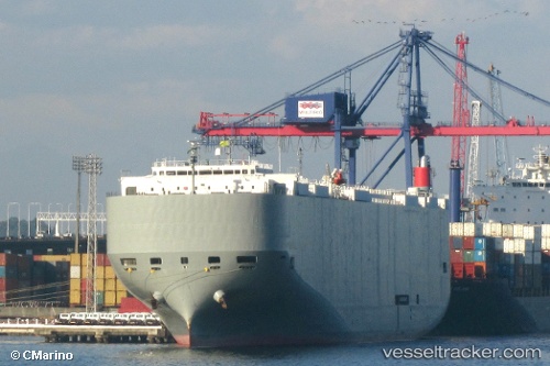
 Brasilia Highway
Current Status
Where is the vessel?
Brasilia Highway is currently in 18 nm SW of Sociedad Portuaria Regional Cartagena, based on AIS data received less than 1h ago.
Latest AIS update:
Current position: 10.28107° N, 75.80535° W (18 nm SW of Sociedad Portuaria Regional Cartagena)
Average speed (last 7 days): Loading…
Average speed (last 30 days): Loading…
Vessel profile: Brasilia Highway is a Vehicles Carrier with dimensions 199m x 32m.
This page combines live AIS, route history, probable destination signals, nearby traffic, and port activity for practical vessel monitoring.
The current position of vessel Brasilia Highway is 10.28107 lat / -75.80535 lng. Updated: 2026-04-25 10:01:18 UTCNearest reference points:
- Near Sociedad Portuaria Regional Cartagena
- Near Contecar
- 62 nm NE of Playón Chico
Currently sailing under the flag of Panama ![]()
Brasilia Highway built in 2009 year
Deadweight:
18793 tDetails:
Live Vessel Brasilia Highway Analytics (details, animations, etc.)
Recent AIS points (UTC):
2026-04-25 06:16:50 UTC · 10.30532, -75.82476 · SOG 0.1 kn · COG 122°2026-04-25 07:26:55 UTC · 10.29846, -75.82203 · SOG 0.5 kn · COG 89°
2026-04-25 07:50:01 UTC · 10.29498, -75.82044 · SOG 0.7 kn · COG 93°
2026-04-25 10:01:18 UTC · 10.28107, -75.80535 · SOG 0.7 kn · COG 83°