 vesseltracker.com
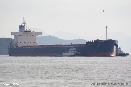
 Efraim A
Current Status
Where is the vessel?
Efraim A is currently in 106 nm NW of Jolo, based on AIS data received about 1h ago.
Latest AIS update:
Current position: 7.60023° N, 120.14308° E (106 nm NW of Jolo)
Average speed (last 7 days): Loading…
Average speed (last 30 days): Loading…
Vessel profile: Efraim A is a Bulk Carrier with dimensions 229m x 32m.
This page combines live AIS, route history, probable destination signals, nearby traffic, and port activity for practical vessel monitoring.
The current position of vessel Efraim A is 7.60023 lat / 120.14308 lng. Updated: 2026-05-15 00:19:24 UTCNearest reference points:
- 66 nm W of Jolo
- 21 nm NW of Zamboanga
- 35 nm SE of Brookes Point, Palawan
Currently sailing under the flag of Cyprus ![]()
Efraim A built in 2010 year
Deadweight:
82174 tDetails:
Live Vessel Efraim A Analytics (details, animations, etc.)
Recent AIS points (UTC):
2026-05-14 19:52:00 UTC · 8.54167, 120.29500 · SOG 12 kn · COG -1°2026-05-14 21:24:53 UTC · 8.22265, 120.23525 · SOG 12.5 kn · COG 188°
2026-05-14 22:21:58 UTC · 8.02167, 120.20500 · SOG 13 kn · COG -1°
2026-05-15 00:19:24 UTC · 7.60023, 120.14308 · SOG 13.3 kn · COG 198°