 vesseltracker.com
 Amami
Amami
Current Status
Where is the vessel?
Amami is currently in Near Daxie Pt, based on AIS data received about 3d ago.
Latest AIS update:
Current position: 29.77328° N, 122.06697° E (Near Daxie Pt)
Average speed (last 7 days): Loading…
Average speed (last 30 days): Loading…
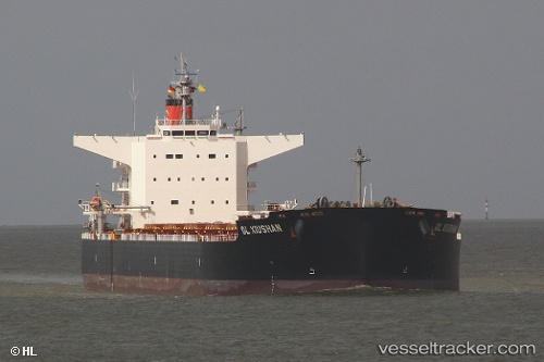
Vessel profile: Amami is a Bulk Carrier with dimensions 240m x 240m.
This page combines live AIS, route history, probable destination signals, nearby traffic, and port activity for practical vessel monitoring.
The current position of vessel Amami is 29.77328 lat / 122.06697 lng. Updated: 2026-05-10 23:53:10 UTCNearest reference points:
- Near Daxie Pt
- 10 nm SE of Daxie Pt
- 11 nm S of Daxie Pt
Currently sailing under the flag of Marshall Is ![]()
Amami built in 2011 year
Deadweight:
98681 tDetails:
Live Vessel Amami Analytics (details, animations, etc.)
Recent AIS points (UTC):
2026-05-10 23:53:10 UTC · 29.77328, 122.06697 · SOG 0 kn · COG 132°2026-05-10 23:53:10 UTC · 29.77328, 122.06697 · SOG 0 kn · COG 132°
2026-05-10 23:53:10 UTC · 29.77328, 122.06697 · SOG 0 kn · COG 132°
2026-05-10 23:53:10 UTC · 29.77328, 122.06697 · SOG 0 kn · COG 132°