 vesseltracker.com
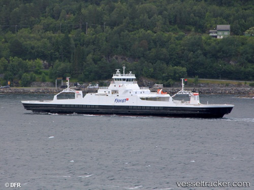
 Norangsfjord
Current Status
Where is the vessel?
Norangsfjord is currently in Near Aukra, based on AIS data received less than 1h ago.
Latest AIS update:
Current position: 62.77651° N, 6.97230° E (Near Aukra)
Average speed (last 7 days): Loading…
Average speed (last 30 days): Loading…
Vessel profile: Norangsfjord is a Passenger Ro Ro Cargo Ship with dimensions 114m x 17m.
This page combines live AIS, route history, probable destination signals, nearby traffic, and port activity for practical vessel monitoring.
The current position of vessel Norangsfjord is 62.77651 lat / 6.97230 lng. Updated: 2026-05-14 19:43:54 UTCNearest reference points:
- Near Aukra
- Near ELNESVAGEN
- Near Brattvåg
Currently sailing under the flag of Norway ![]()
Norangsfjord built in 2010 year
Deadweight:
1050 tDetails:
Live Vessel Norangsfjord Analytics (details, animations, etc.)
Recent AIS points (UTC):
2026-05-14 16:07:55 UTC · 62.77515, 6.96748 · SOG 11.3 kn · COG 83°2026-05-14 16:17:18 UTC · 62.77518, 6.96628 · SOG 9.4 kn · COG 282°
2026-05-14 17:23:24 UTC · 62.77711, 6.94113 · SOG 9.9 kn · COG 283°
2026-05-14 19:43:54 UTC · 62.77651, 6.97230 · SOG 0 kn · COG 47°